Liljeholmen in southwestern Stockholm offers a compelling example of industrial transformation along the waterfront. Once dominated by factories, storage facilities, and transport infrastructure, the area played a key role in Stockholm’s supply systems and urban expansion. Today, modern housing and commercial spaces have replaced much of the industry, yet traces of its industrial past remain embedded in the landscape.
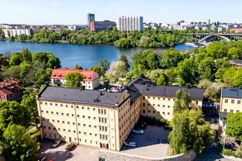
Few areas in Stockholm illustrate the connection between industry, transport, and urban growth as clearly as Liljeholmen. Situated along Lake Mälaren, this district once functioned as a vital industrial waterfront—where goods arrived, were stored, processed, and distributed across the city. Today, Liljeholmen has transformed into a modern residential and commercial area, yet its geography and structure still reflect its industrial origins.
Liljeholmen forms part of Stockholm’s wider industrial heritage, where production sites, infrastructure, and transport systems worked together as an interconnected network. Unlike factory environments such as Almgren Silk Factory or early industrial communities like Wira Bruk, Liljeholmen highlights the role of logistics and distribution within this system.
Liljeholmen illustrates the role of transport and infrastructure within Stockholm’s wider industrial system, connecting to the themes explored in Industrial Heritage Stockholm.
🏭 Industrial Waterfront and Transport Hub
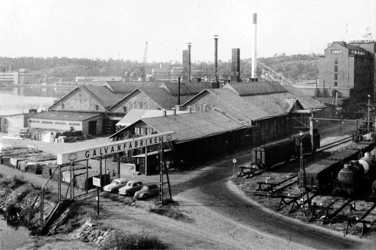
Liljeholmen developed as an important industrial waterfront area due to its strategic location along Lake Mälaren. Water transport, rail connections, and proximity to central Stockholm made it ideal for factories, storage, and logistics.
Goods moved through Liljeholmen efficiently—linking regional production with urban consumption. Workers, transport crews, and dock operations kept this flow constant, making Liljeholmen a vital link between production and everyday life in Stockholm.
🧱 Infrastructure and Industrial Scale
Unlike workshop-based areas such as Atlasområdet, Liljeholmen was shaped by infrastructure:
- Warehouses and storage facilities
- Rail connections and loading areas
- Bridges linking southern Stockholm to the city
- Waterfront docks for transport and distribution
This created a landscape defined not only by production—but by movement and flow.
✦ What to Look for in Liljeholmen
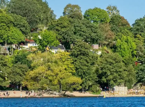
- Waterfront Layout: The shoreline reveals how goods once moved through the city
- Bridges and Connections: Infrastructure that supported industrial logistics
- Urban Scale: Wide spaces shaped by transport rather than housing
- Modern Layers: New buildings built on former industrial ground
⚙️ Industry, Transport, and Urban Growth
Liljeholmen represents a crucial aspect of industrial history:
- Not just production
- But distribution
- And the infrastructure that made large-scale urban life possible
It shows how Stockholm functioned as a connected system—linking water, rail, infrastructure, and urban life.

🔄 From Industry to Urban Living
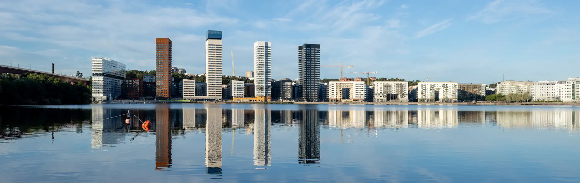
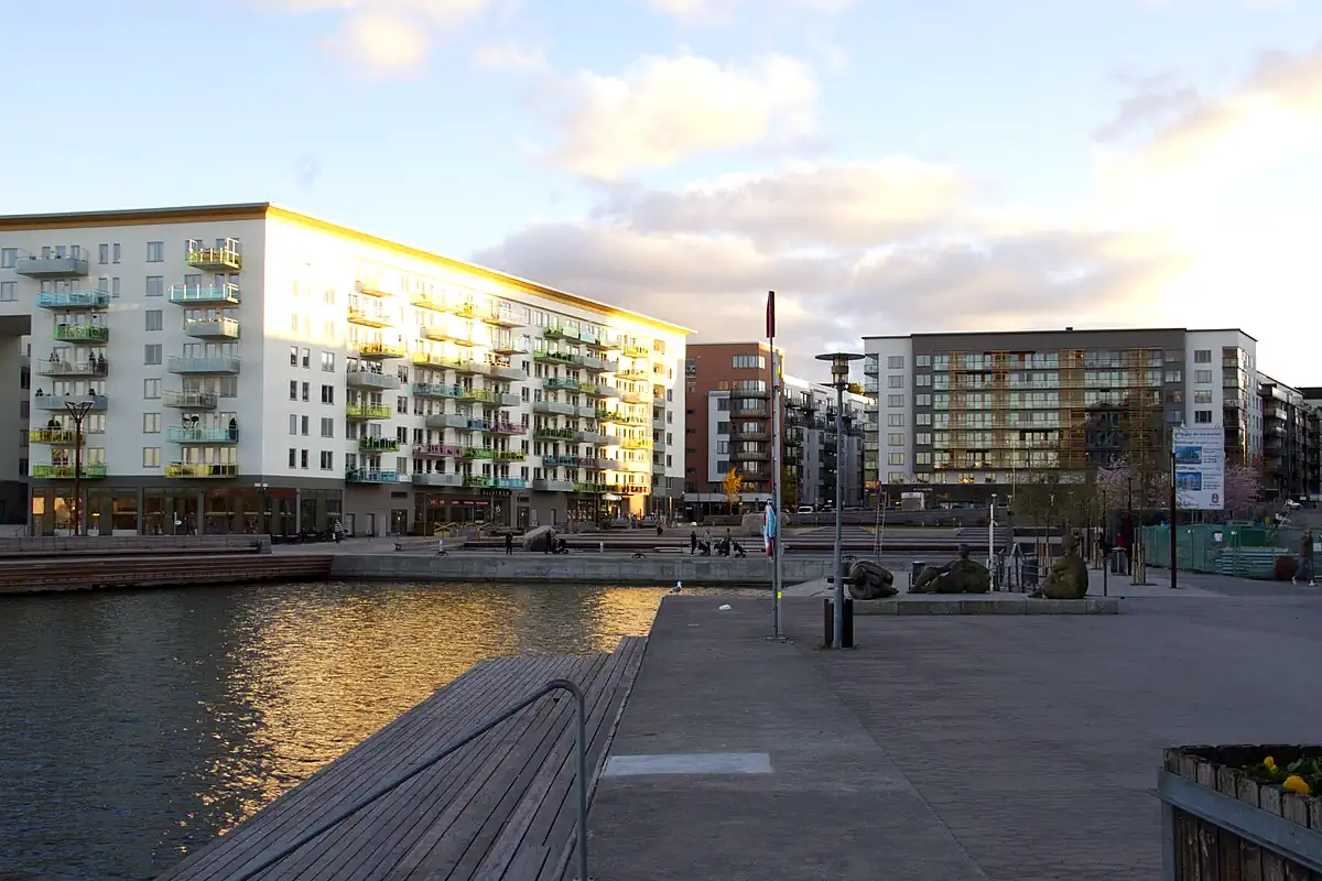
Today, Liljeholmen has undergone a major transformation:
- Former industrial land → housing and offices
- Transport infrastructure → urban connections
- Waterfront → public and residential space
Yet the structure of the area still reflects its industrial logic.
🧭 A Transitional Industrial Landscape
Compared to:
- Atlasområdet → small-scale workshops
- Slakthusområdet → intact industrial district
- Telefonplan → fully transformed industrial campus
👉 Liljeholmen represents:
- a transitional landscape shaped by infrastructure and continuous redevelopment
🏭 Part of Stockholm’s Industrial Landscape
Liljeholmen connects to a wider network of industrial environments across Stockholm, including:
- Atlasområdet
- Slakthusområdet
- Telefonplan
- Vinterviken
Together, these areas reveal how different forms of industry—engineering, food production, telecommunications, explosives, and infrastructure—shaped the city’s development.
📍 Visitor Information
📍 Location: Liljeholmen, Stockholm
🚇 Getting There: Metro to Liljeholmen
🗺️ Best Way to Explore: Walk along the waterfront and bridges
🔍 What to Expect: Modern cityscape layered over industrial infrastructure
☕ Nearby: Shopping, cafés, and waterfront walks
📍 Nearby Attractions
Vinterviken – Nature and Nobel’s industrial legacy
Årstaviken – Scenic walking paths along the water
Södermalm – Culture, food, and viewpoints